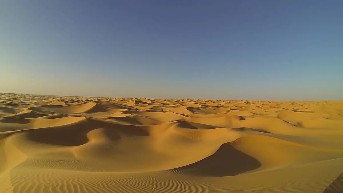
Chapter 7 of Immanuel Velikovsky’s Earth in Upheaval is called Deserts and Oceans. The first section of this chapter is about the Sahara Desert. It is now widely accepted that what is now the largest desert on the planet was formerly a fertile grassland: this sparsely populated expanse of sand once supported a large population of animals and humans. But when did the desertification of this region take place and what was its cause? These are the questions that Velikovsky explores in this section.
The first line of evidence is provided by the relics of human occupation that still litter the desert:
Drawings on rock of herds of cattle, made by early dwellers in this region, were discovered by Barth in 1850. Since then many more drawings have been found. The animals depicted no longer inhabit these regions, and many are generally extinct. It is asserted that the Sahara once had a large human population that lived in vast green forests and on fat pasture lands. Neolithic implements, vessels and weapons made of polished stone, were found close to the drawings. Such drawings and implements were discovered in the eastern as well as the western Sahara. Men lived in these “densely populated” (Flint) regions and cattle pastured where today enormous expanses of sand stretch for thousands of miles. (Velikovsky 86)

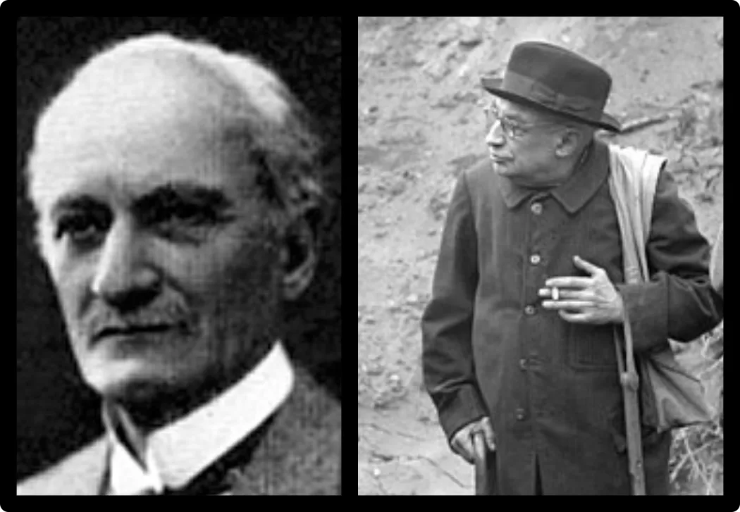
The quote from Flint—Richard Foster Flint, Professor of Geology at Yale University—is unsourced. It actually comes from his Glacial Geology and the Pleistocene Epoch, which Velikovsky cites on multiple occasions in Earth in Upheaval:
Archeologic investigations have established the fact that in prehistoric time the Sahara had a climate much less dry than now and was densely populated. Archeologic evidence suggests that desiccation began in the neighborhood of 8000 to 6000 bce. The lower figure can be readily taken as the beginning of the Climatic Optimum. (Flint 497-498)
Flint’s lower date is not nearly low enough for Velikovsky, so it is not surprising that he omitted this part of the quotation.
The second line of evidence is geological:
Several theories have been offered to explain the prodigious quantity of sand in the Sahara. “The theory of marine origin is now no longer tenable.” [“Sahara,” Encyclopaedia Britannica (14th ed.), Vol. XIX.]
The sand, it was found, is of recent origin. It is assumed that when a large part of Europe was under ice the Sahara was in a warm and moist temperate zone; later the soil lost its moisture and the rock crumbled to sand when left to the mercy of the sun and the wind. (Velikovsky 86-87)
This is still the favoured explanation.
Rock Art in the Sahara
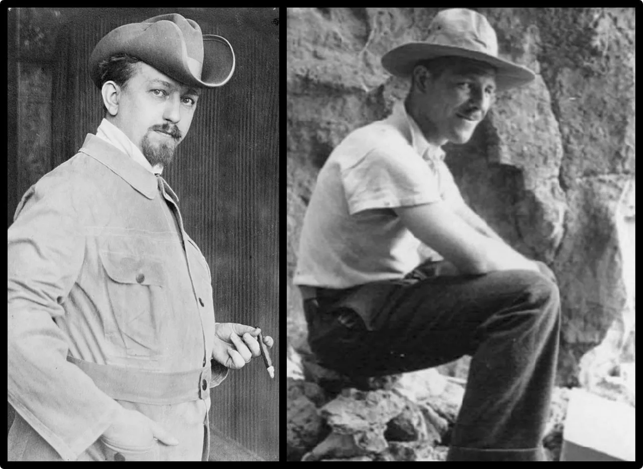
As Velikovsky notes, the existence of rock art in the middle of the Sahara was brought to the attention of Western scholars by the German explorer Heinrich Barth, who took part in James Richardson’s expedition to Ghat in the Libyan Sahara in 1850-51. After Richardson’s death, Barth continued his own explorations across the Sahara to Agadez, Timbuktu and Lake Chad. His German and English accounts of these travels comprise five volumes and run to over three thousand pages. Velikovsky, however, does not actually cite Barth. His principal source for the history of the Sahara’s rock art is Prehistoric Rock Pictures in Europe and Africa by L Frobenius and Douglas C Fox.
Leo Frobenius was a largely self-taught German ethnographer and archaeologist. In 1904 he undertook the first of several expeditions to Africa. He was particularly interested in the rock art discovered by Barth. He became convinced that an ancient civilization in the Sahara was the true source of Plato’s myth of Atlantis.
The anthropologist Douglas Claughton Fox was born in Wales but grew up in New Jersey, New York and Maryland. He was Frobenius’s assistant at the Forschungsinstitut fur Kulturmorphologie (now the Frobenius Institute) in Frankfurt am Main, which Frobenius founded in 1920. Fox took part in a number of the Institute’s research expeditions and collaborated with Frobenius on several English-language books shortly before the latter’s death in 1938, including Prehistoric Rock Pictures in Europe and Africa.
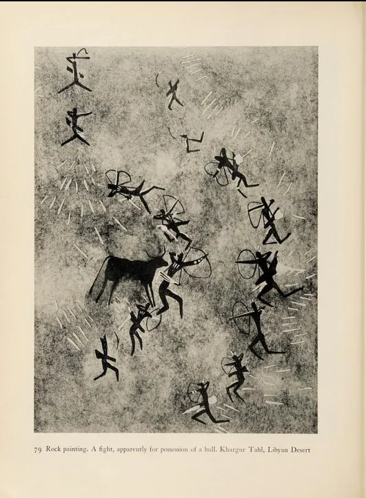
This region south of Tripolitania is known as the Fezzan and was penetrated by British explorers as early as the beginning of the last century. Some eighty years ago Heinrich Barth, German member of a British expedition, found in a desolate valley rock pictures of cattle and of human figures with animal heads. He made sketches of them and showed these to Professor Movers, then the prime authority on such matters, who decided that the pictures were Phoenician, a conclusion in which Duvernier and others agreed ...
In the deep ravines at the very center of the plateau Frobenius found no less than four main picture stations. He writes that here there were two types of pictures, one depicting wild animals, among them giraffes eighteen feet high, the other human figures sometimes with animal heads. The most frequently recurring animals were giraffe, Bubalus antiquus, elephant, rhinoceros and crocodile (or waran). The style in which the human figures were depicted was apparently related on the one side to that of the levant art of Spain and on the other to that of early Egyptian art. There were, for instance, no less than four representations of the Egyptian god Bes.
In the second compositions (human figures), among them the Barth pictures, there often occurred the pictures of cattle which sometimes, Frobenius says, “bore disks between their horns, just as in Egypt. This reminded us that in the Sahara Atlas were pictures of rams with disks between their horns and that Georg Schweinfurth had already posed the question of whether or not these could be the ur-pictures of the Egyptian ram god, Jupiter Ammon.”
A year later Frobenius found in the Libyan Desert rock paintings which were quite clearly those of the Egyptian god Set ... (Frobenius & Fox 38 ... 39-40)
Franz Karl Movers was a German theologian and Orientalist, whose scholarly reputation rested upon his extensive studies of the Phoenicians, published in several volumes under the title Die Phönizier between 1841 and 1856.
Duvernier is an error for Duveyrier. Henri Duveyrier was a French geographer, who explored the Sahara between 1857 and 1861 after meeting Heinrich Barth in London.
The theory that the pictures of rams in the Sahara Atlas with solar disks between their horns represented the Egyptian god Ammon has now been abandoned by mainstream scholars. The lines in these pictures that had been interpreted as solar rays are now considered to represent feathers, plant stems or leaves (Searight 193). As for Frobenius’s pictures of cattle with disks between their horns, I have failed to come across any such pictures on the Internet.
Velikovsky concludes this paragraph with a quote from Sahara, a book that was fresh off the printing press when Earth in Upheaval was being written:
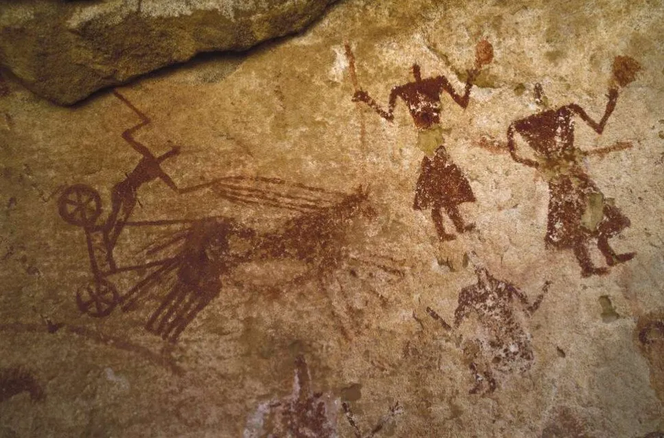
By the side of the old caravan routes between the Fezzan and the Hoggar are magnificent rock paintings of war chariots being drawn across the land by horses—in areas where these animals could not now survive two days without extraordinary precautions. (Lecler 46)
Velikovsky cites the author of this work as P. LeCler, but his name was René Lecler. Some editions of Earth in Upheaval also misspell his surname as LeClerc. Lecler, a Belgian journalist and explorer of the Sahara, goes on to describe the alteration of the Sahara from fertile grassland to desert as a great climatic catastrophe (Lecler 46).
These chariots are commonly attributed to the Garamantes, who are said to have used four-horse chariots in Herodotus’s day—but they hardly used them in the middle of the desert, where they are depicted on rocks (Herodotus 4:183:4). In fact, Herodotus tells us explicitly that the Garamantes who dwell inland have no weapons of war, nor know how to defend themselves (Herodotus 4:174:1).
Lake Tritonis
Velikovsky draws an important conclusion from this unusual mix of details:
The extinct animals in the drawings suggest that these pictures were made sometime during the Ice Age; but the Egyptian motifs in the very same drawings suggest that they were made in historical times. (Velikovsky 87)
The solution to this quandary he finds in catastrophism:
The conflict between the historical and the paleontological evidence, and of both of them with the geological evidence, is resolved if one or more catastrophes intervened. It appears that a large part of the region was occupied by an inland lake, or vast marsh, known to the ancients as Lake Triton. In a stupendous catastrophe the lake emptied itself into the Atlantic, and the sand on its bottom and shores was left behind, forming a desert when tectonic movements sealed off the springs that fed the lake. The “land of pastures and forests” became a desert of sand; hippopotami that live in water and elephants disappeared, and with them also the hunter and the farmer. (Velikovsky 88)
The quotation land of pastures and forests is unsourced. In the opening paragraph, Velikovsky writes of the Sahara’s former human population living in vast green forests and on fat pasture lands. The source of both is René Lecler’s Sahara:
One of the early explorers who heard the inhabitants of In-Salah speak of a time when their city was in the center of a vast and green forest with fat pasturelands all around thought that this was a very tall story indeed. Yet a few years later, others came across petrified remains of forest type vegetation in places as far removed from one another as the Tuat Valley and Tassili of the Ajjers. It now appears certain that sometime in the Tertiary or Quaternary period some vast and unheralded climatical change traversed North Africa, gradually desiccating it, reducing its vegetation to a few miserable species, and forcing its once abundant animal life to disappear completely or find other habitats. (Lecler 44-45)
Velikovsky had also briefly discussed Lake Triton in Worlds in Collision:
Athene, or Latin Minerva, is called Tritogeneia (or Tritonia) after the lake Triton. This lake disappeared in a catastrophe in Africa when it broke into the ocean, leaving the desert of Sahara behind it, a catastrophe connected with the birth of Athene. Diodorus, referring to undisclosed older authorities, says that Lake Triton in Africa “disappeared from sight in the course of an earthquake, when those parts of it which lay toward the ocean were torn asunder.” This account implies that a great lake or marsh in Africa, separated from the Atlantic Ocean by a mountainous barrier, disappeared when the barrier was broken or lowered in a catastrophe. Ovid says that Libya became a desert in consequence of Phaethon’s conflagration. (Velikovsky 1965:169)
The name of the lake was actually Tritonis. In Herodotus, Triton is the name of a river that flowed into Lake Tritonis (Herodotus 4:178)). According to the Periplus of Pseudo-Scylax, which probably dates from the 4th century bce, all that was left of the lake in Hellenistic times was an area 1000 stades in circumference—about 2,300 km2, or comparable in size to Luxembourg (Pseudo-Scylax § 110).
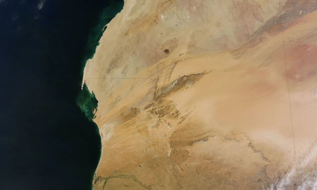
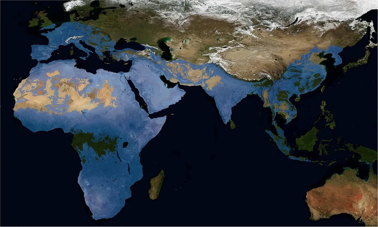
Could the story recorded by Diodorus of Sicily be a reminiscence of an ancient catastrophe? In satellite images of the Western Sahara, the desert is marked with long streaks, as though a catastrophic flood scoured the land and drained into the Atlantic Ocean.
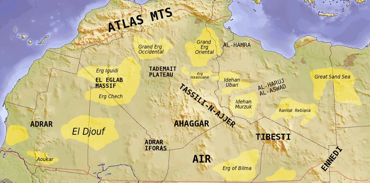
The original size of Lake Tritonis might be indicated by the distribution of the Sahara’s sandy ergs, which now cover about 25% of the desert.
André Berthelot and Abbé Breuil
Velikovsky's penultimate source in this section is André Berthelot’s L’Afrique Saharienne et Soudanaise [Saharan and Sudanese Africa]. Berthelot was a French professor of ancient history and the secretary-general of La Grande Encyclopédie, a 31-volume encyclopedia published between 1886 and 1902 to replace Denis Diderot famous Encyclopédie. The subtitle of his work about the Sahara is ce qu’en ont connu les Anciens, what the ancients knew about it. Velikovsky’s quotation, I presume, was translated from Berthelot’s French by Velikovsky himself:
Il se peut que l’homme de l’âge de pierre ait assisté en Afrique à trois événements considérables ; l’écroulement de la chaîne hispano-atlasique entraînant l’ouverture du détroit de Gibraltar, jonction actuelle de la Méditerranée et de l’Océan ; l’effondrement qui a isolé du continent africain les îles Canaries ; l’ouverture du détroit de Bab-el-Mandeb, séparant l’Arabie de l’Éthiopie.
It is possible that Stone Age man witnessed in Africa three notable events: the sinking of the Spanish-Atlas chain that opened the Strait of Gibraltar and created a junction between the Mediterranean Sea and the Ocean; the collapse that cut off the Canary Islands from the African continent; the opening of the Strait of Bab-el-Mandeb, separating Arabia from Ethiopia. (Berthelot 85, Velikovsky 87-88)
The final source mentioned by Velikovsky in this section is Henri Breuil, a French priest turned archaeologist, anthropologist and geologist.
Berthelot, however, ascribed these great tectonic changes to the time of prehistoric man and Abbé Breuil actually showed that prehistoric man already occupied these regions as the eolithic or very crudely chipped stone artifacts indicate. (Velikovsky 88)
Velikovsky does not cite any specific work of Breuil’s, who is mentioned here for the first and last time in Earth in Upheaval. This may mean that the reference was taken from another of Velikovsky’s sources. But from which one? Breuil is not mentioned in Berthelot’s work.
Eolith was the name anthropologists gave to what they believed were the earliest stone tools manufactured by prehistoric cultures as early as the Pliocene Epoch (5.3–2.6 Mya), or even the Eocene (56–34 Mya). Their true nature was the subject of a heated debate that lasted for several decades, until a wide consensus was reached by mainstream scholars that they had been created by natural processes, such as erosion or geological pressure. If this conclusion was the correct one, then Abbé Breuil’s opinion that the presence of prehistoric humans in the regions mentioned dated from a very remote period is no longer tenable—on these grounds, at least.
This is, however, a moot point, as we now have an abundance of other evidence proving that both Homo erectus and Homo heidelbergensis were distributed over a large part of the Old World as early as 1.7 Mya. Two early cultures of genuine stone tools—the Oldowan and the Acheulean—are now thought to have been developed as early as 2.6 Mya and 1.76 Mya respectively. Oldowan tool have been found as far afield as China, Hungary, France and South Africa, while Acheulean tools were spread across most of Africa and much of southern Asia and western Europe.
Curiously, Breuil’s main contribution to the debate over eoliths was a 1910 paper in which he claimed that the so-called eoliths found at the bottom of Eocene strata in France were in fact of natural origin:
In 1910, Henri Breuil conducted investigations he thought would put an end to the eolith controversy. In his often cited report, he said he found flints resembling stone tools in the Thanetian formation at Belle-Assise, near Clermont, France. This formation is Early Eocene, making the flints about 50-55 million years old. But Breuil could not imagine human beings-existed in the Eocene. How, then, had the flint objects been produced? During his excavations, Breuil found a few pieces of flint with detached flakes lying nearby. Some of these detached flakes had bulbs of percussion. Others had some flaking on them that resembled retouching. The cause of these effects, according to Breuil, was simply geological pressure. (https://www.scritub.com/limba/engleza/history/TWO-FAMOUS-DEBUNKERS-OF-EOLITH172145101.php)
Conclusion
Velikovsky concludes this section with a description of what he believes happened, and when it happened:
But at a later date people of advanced culture, contemporary with pharaonic Egypt, lived in communities, pastured their cattle, and left their tools and drawings there. Then in an upheaval, of which many traditions persist in classical literature, the Atlas Mountains were torn apart, the great lake was emptied, and the watery region became the great and awesome desert the Sahara. (Velikovsky 88)
Today it is believed that the Sahara has repeatedly oscillated between desert and savanna in a cycle which takes about 20,000 years to complete and which is driven by the precession of the Earth’s axis. This pattern has been continuing for several hundred thousand years. The most recent desertification is now thought to have taken place in two abrupt episodes: the first occurred between 4700 and 3500 bce: the second, which was much more severe, between 2000 and 1600 bce (Claussen et al).
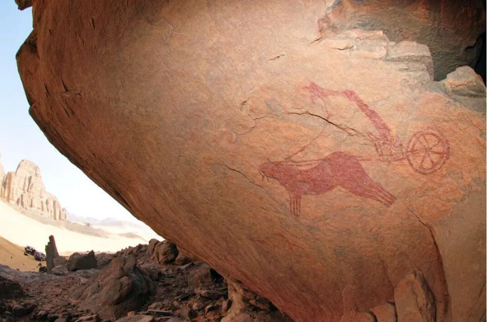
The fact that sophisticated horse-drawn chariots are depicted in the desert in areas where these animals could not possibly survive today argues that the desiccation of the Sahara occurred at a time when civilization had already arisen in this region. The so-called Horse Period, when the horse-drawn war chariots were depicted, is conventionally dated to 3200–1000 BP—ie from 1200 bce to 1000 ce (Coulson & Campbell 29). But this is contemporary with Egyptian history from the 19th Dynasty on, when the desertification was all but complete. Either these chariots are evidence of an Ice Age civilization that flourished long before the rise of Pharaonic Egypt, or the catastrophe that befell this region occurred much more recently than mainstream geologists are willing to claim, and it was not caused by gradualist process such as precession.
And that’s a good place to stop.
References
- André Berthelot, L’Afrique Saharienne et Soudanaise: Ce qu’en ont connu les anciens, Les Arts et le Livre, Paris (1927)
- Abbé Breuil, Sur la présence d’éolithes à la base de l’Eocène parisien, L’Anthropologie, Volume 21, Number 1, Pages 385-408 Masson et Cie, Paris (1910)
- David Coulson & Alec Campbell, Rock Art
of the Tassili n Ajjer, Algeria, Adoranten, Pages 24-38, Scandinavian Society for Prehistoric Art, Tanum, Sweden (2010) - Richard Foster Flint, Glacial Geology And The Pleistocene Epoch, John Wiley And Sons, Inc, New York (1955)
- Leo Frobenius & Douglas C Fox, Prehistoric Rock Pictures in Europe and Africa, The Museum of Modern Art, New york (1937)
- René Lecler, Sahara, Hanover House, Garden City, New York (1954)
- Warren E Preece (editor), Encyclopædia Britannica, Revised 14th Edition, Volume 19, Encyclopædia Britannica, Inc, Chicago (1973)
- Susan Searight, The Prehistoric Rock art of Morocco: A Study of Its Extension, Environment and Meaning, Doctoral Thesis, Bournemouth University (2001)
- Immanuel Velikovsky, Earth in Upheaval, Pocket Books, Simon & Schuster, New York (1955, 1977)
Image Credits
- The Sahara Desert: © Fintan Corrigan (drone photographer), Creative Commons License
- Richard Foster Flint: Copyright Unknown, Fair Use
- Rock Painting from the Sahara Desert (Frobenius & Fox 60): Khargur Tahl, Libyan Desert, Frobenius Institute, Public Domain
- Leo Frobenius: George Grantham Bain Collection, Library of Congress, Washington, DC, Public Domain
- Douglas Claughton Fox: © Frobenius-Institut (photograph), Fair Use
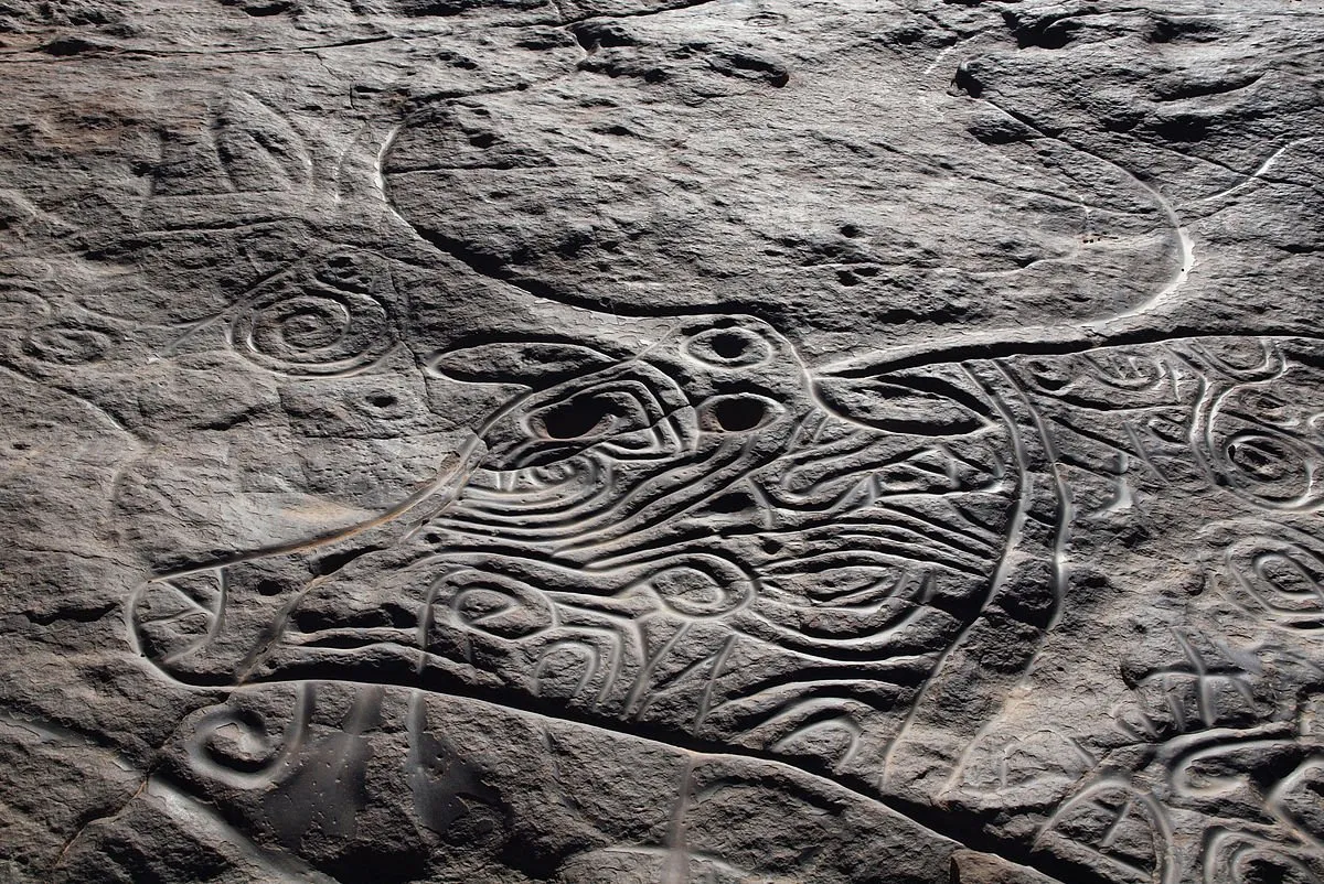
- A Petroglyph of Bubalus antiquus in the Algerian Sahara: © Linus Wolf (photographer), Creative Commons License
- Map of the Sandy Ergs of the Sahara: © T L Miles (designer), Creative Commons License
- Western Sahara: NASA Visible Earth, Public Domain
- André Berthelot: Agence Rol (photograph), Bibliothèque nationale de France, Public Domain
- Henri Breuil: © Marcel Lefranq (photographer), Creative Commons License
- The Distribution of Acheulean Tools: © Alastair J M Key, Ivan Jarić & David L Roberts, Fair Use : Satellite Image: NASA Visible Earth, Public Domain
- A Two-Horse Chariot in the Sahara: Two-Horse Chariot & Charioteer with Armed Warriors, Acacus Mountains, Libya, © David Coulson (photographer), Trust for African Rock Art, Fair Use
- A War Chariot in the Sahara: Two-Horse Chariot & Charioteer, Tihenagdal, Libya, © David Coulson (photographer), Trust for African Rock Art, Fair Use