New Hebrides
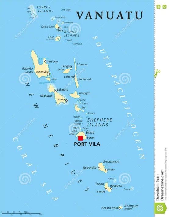
Europeans first began to arrive in the New Hebrides Islands in 1606, by the 18th Century the Island Group was colonized by both French and English settlers.
In 1906 the two European powers agreed to share power in the Island Group, each appointing a Resident to oversee the administration of the Group, thus making the Condominium a unique one in the history of European Colonization.
The British set up their capital in Hog Harbour, while the French set up at Segond.
When France was defeated by Germany in 1940, despite the presence of the French Resident, [who now answered to the Vichy Government], the British Resident became the one with most influence over the course of the war.
In early 1941, the Australian Military established the New Hebridies Defence Force based on the Island of Malekula, this force grew to 2,000 Australians and Colonials.
When the Pacific War began on 6th December 1941, because of the strategic location of the New Hebrides between the USA and Australia, and the close proximity of the Solomons, the islands of Espiritu Santo, Efate and others in the Island Group became important military bases for the Allied war efforts.
On Espiritu Santo the US 3rd Construction Battalion [ Seabees] prepared a bomber strip 6.000 feet long in virgin forest in 20 days.
From the middle of October until 6th December 1942, No 3 [BR] Squadron operated from Pallikulo, during the last fortnight of this period a detached flight of 6 aircraft were Stationed at Guadalcanal.
They were tasked with daily patrols of 2 to 4 aircraft over the seas up to 400 miles from their base, as well as regular Submarine patrols within a radius of 20 miles from Segond Channel.
One possible contact was made by a Hudson sighted what might have been a Submarine 10 mikes away, but nothing was found despite extensive searching.
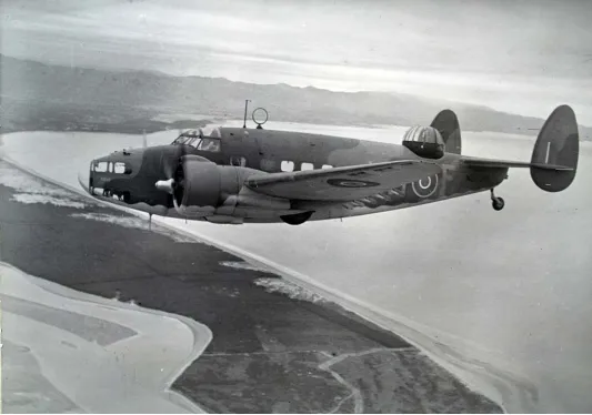
Lockheed Hudson
Three weeks later another Hudson dropped bombs on what appeared to be a periscope, but there was no oil or wreckage from the attack.
After the war, both Britain and France continued to administer the Island Group until 1980 when the Islands gained Independence and became Vanuatu.
Island Espritu Santo
Pallikulo Bay
[BR] = Bomber Reconnaissance
[F]= Fighter
[G]SU = Support Unit [the ground crew that serviced the Aircraft]
Sqn = Squadron
15 [F] Squadron 3 January to 20 March 1943
14 [F] Squadron April to June 1943
16 [F] Squadron 19 June to July 1943
14 [F] Squadron 25 July to 29 July 1943
17 [F] Squadron 29 July to 11 September 1943
18 [F] Squadron 17 September to October 1943
14 [F] Squadron October to November 1943
16 [F] Squadron November 1943
17 [F] Squadron 19 December 1943 to 17 January 1944
16 [F] Squadron January to March 1944
25 [F] Squadron 12 January to March 1944
18 [F] Squadron January 1944
20 [F] Squadron April 1944
16 [F] Squadron 12 May to August 1944
17 [F] Squadron August 1944
18 [F] Squadron August to September 1944
20 [F] Squadron August to September 1944
22 [F] Squadron August 1944
15 [F] Squadron September to October 1944
23 [F] Squadron September to October 1944
24 [F] Squadron October to December 1944
14 [F] Squadron November to December 1944
22 [F] Squadron December 1944 to January 1945
25 [F] Squadron December 1944
17 [F] Squadron January 1945
15 [F] Squadron January to February 1945
19 [F] Squadron February to March 1945
24 [F] Squadron March 1945
16 [F] Squadron April 1945
3 [BR] Squadron 15 October to 6 December 1942
9 [BR] Squadron March to October 1943
3 [BR] Squadron 23 October 1943 to January 1944
2 [BR] Squadron November 1943 to 12 February 1944
9 [BR] Squadron February to May 1944
3 [BR] Squadron May to July 1944
1 SU June 1943
12 SU [DB] June 1943
25 SU [DB] 12 December 1943 to 15 May 1944
Segond Channel
Whenever strikes were flown against Rabaul, a Catalina, with a fighter escort, was sent to patrol South of New Ireland to pick up any downed pilots.
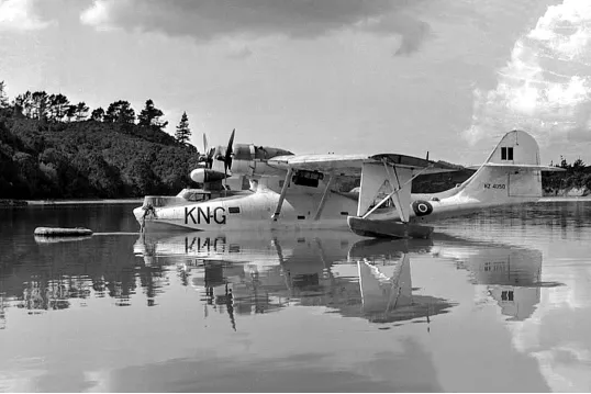
Consolidated PBY Catalina NZ 4050
The two RNZAF Squadrons picked up 28 men between Bougainville and the Gazelle Peninsula.
[M]= Maritime
5 [M] Squadron 11 November 1944 to October 1945
6 [M] Squadron October to 22 December 1943
Luganville
[TB] = Dive Bomber
No 30 [TB] Squadron was formed at Gisborne in June 1943 and trained as a Torpedo Bomber Squadron .
The Servicing Unit was to leave NZ by sea on 24th January 1944, but were prevented from doing so by a lack of shipping facilities.
A team of 3 Officers and 2 men were flown to Santo on 27th January to prepare for the Squadrons arrival, planed for early February.
On arrival they found that there was insufficient people in the advance party for the amount of work to be done, so a further detachment of 44 men was flown up on the 30th January 1944.
The Squadrons Aircraft were flown via Norfolk Island and Tontouta in two echelons, leaving NZ on the 28th and 30th and the remainder of the servicing unit travelled by sea, on the US Alchiba, arriving at Santo on the 10th February 1944.
The need for Torpedo Bombers in the South Pacific had now passed and the Squadron spent the next month practicing glide and dive bombing with US Units.
In early March the Servicing Units were shipped to Bougainville, visiting Guadalcanal on the way.
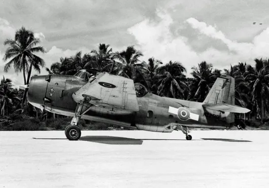
Grumman TBF Avenger
[TB] = Torpedo Bomber
30 [TB] Squadron February to March 1944
30 SU [DB] 10 February 1944
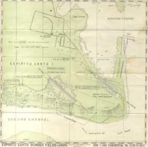
Ref. No. 26b. MAP OF ESPIRITU SANTO BOMBER FIELDS. June 1 1943. Confidential. No. 12-20-12-1 & 3-L. Produced by the N.A.C.A.
(file:///I:/R%20N%20Z%20A%20F/1%20STATIONS%20N%20Z/museummaps.htm)
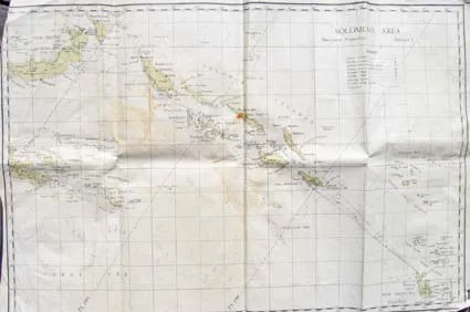
MAP OF SOLOMON ISLANDS - ADCHART 1. November 1943.
Covers area from New Hebrides (Vanuatu) to south-east, Papua New Guines to west, New Britain to north, New Ireland, Bougainville and the Solomon Islands. Includes location of Allied and "enemy" airfields. Airfields include Espiritu Santo, Turtle Bay, Henderson, Careny, Russell, Rekata Bay, Segi, Munda, Vila, Barakoma, Faisi, Ballale, Kahili, Kieta, Tenekau, Bonis, Buka, Namatanai, Borpop, Keravat, Vunakanau, Lakunai, Rapopo, Tobera, Gasmata, and Milne Bay. Map has been used with track lines drawn from Espiritu Santos to Henderson, up to Torokina and across to Jacquinot Bay.
(file:///I:/R%20N%20Z%20A%20F/1%20STATIONS%20N%20Z/museummaps.htm)![]

with thanks to son-of-satire for the banner
